 Ushuaia City Guide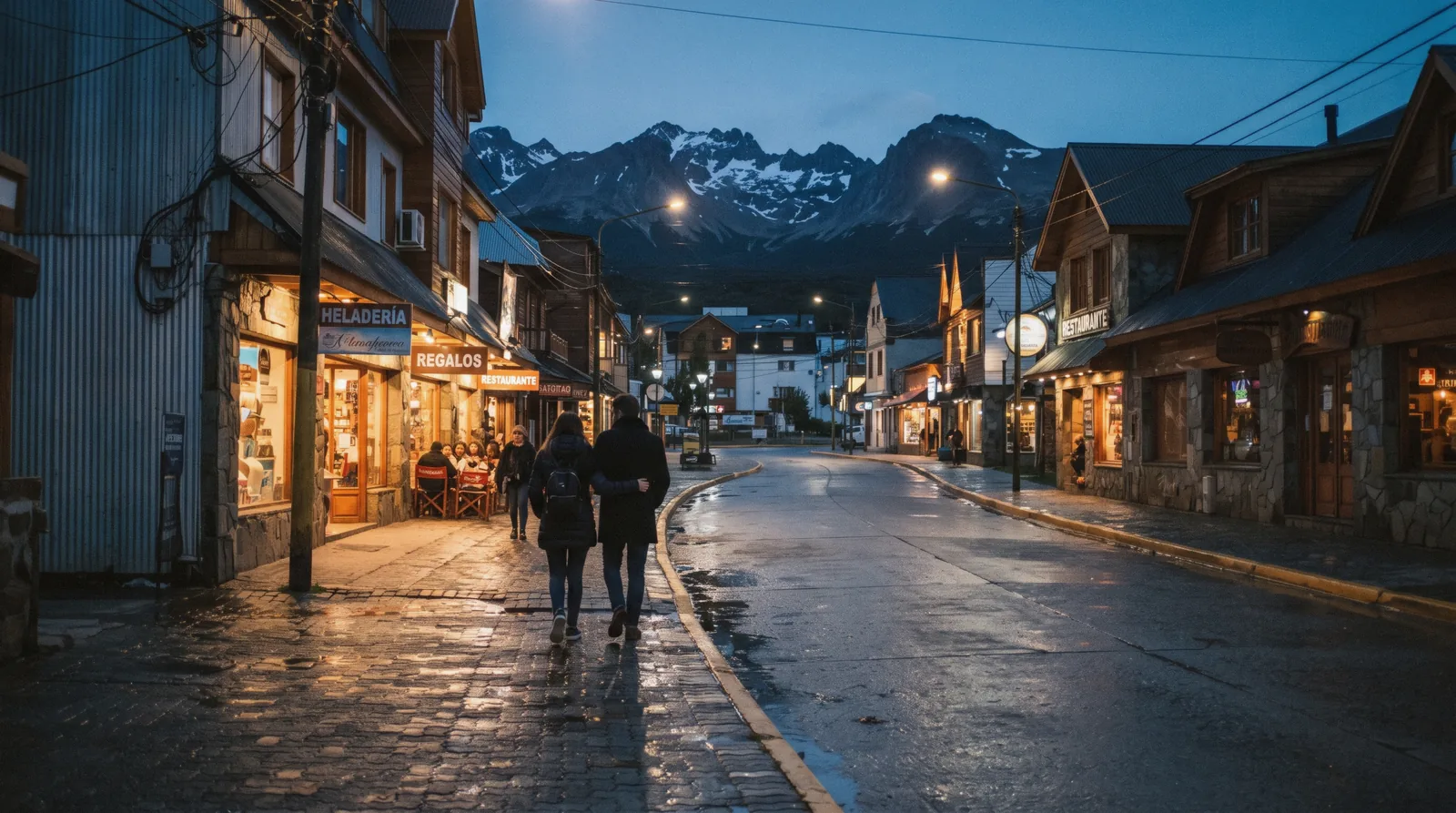
Is Ushuaia Safe? The Honest Answer
Is Ushuaia safe? For street crime the honest answer is yes by the standards of any Argentine city, because this is a small town whose economy depends on tourism. The safety page you actually need is about wind, cold, mud and the national park trails, and this guide covers both sides. The whole guide starts on the Ushuaia city guide.
Quick answer The short answer on safety in Ushuaia
Is Ushuaia safe? Yes for violent crime, by Argentine standards and by comparison with most cities a visitor will know. It is a small town of roughly 80,000 people that lives on tourism, and street trouble against visitors is rare. The risks that actually send travellers to a clinic here are not criminals. They are the weather and the trail: wind chill on the Beagle Channel waterfront, hypothermia on a walk that started sunny, a twisted ankle in a peat bog, and being caught out after dark in winter when daylight lasts about 7.5 hours around the June solstice. Carry the two emergency numbers that matter. 911 is the general emergency line. 107 is the medical emergency line. Ushuaia sits at sea level, so altitude sickness is not a factor here at all.
Key takeaways
- Violent crime is rare and the usual pickpocket prudence in the town centre covers the rest, so the answer to is Ushuaia safe is yes for the streets.
- The real risk is the weather. Check our Ushuaia weather page before any walk, because average daily maximum wind speeds run near 18 m/s in December.
- On foot and by getting around town, taxis at night and care at ATMs are the practical habits that matter.
- Day tours such as the Beagle Channel catamaran cruise keep you with an operator who makes the weather call for you, which is the safest format for a first visit.
- For the wider planning picture, see our Ushuaia plan hub, which pulls together costs, timing and this safety page.
Town, Night and Money
The town itself is the easy part of the Ushuaia safety question. This is what ordinary prudence looks like on San Martín street at ten at night, and why almost no visitor reports trouble.
A Small Town That Lives On Tourism
Ushuaia is the capital of Tierra del Fuego province and the southernmost city in the world, but it does not feel like a capital. The built-up centre is a few long streets between the Martial hillside and the port. The economy runs on cruise ships, the national park, the Beagle Channel and the ski season, which means nearly everyone you deal with has a direct interest in visitors having an uneventful time.
Street violence against tourists is rare by the standards of larger Argentine cities. This is our judgement drawn from the shape of the place and the official tourist office's own presentation of the town, not a published statistic, because no official page we checked publishes crime rates for the city.
Ordinary Prudence Covers It
The habits that serve you in any Argentine city serve you here. Keep bags zipped and in front of you on the Avenida San Martín. Do not leave phones on café tables facing the street.
Hold your camera strap when you stop for the sea lions at the waterfront. That is genuinely the whole list for most people. The town empties outside the cruise and summer season, and the streets around the port are quiet after the restaurants close.
We would not describe night walking as dangerous, merely as cold, windy and dimly lit away from the main streets, which is a different problem.
ATMs and Cards
Money is where the small practical annoyances live. ATMs in the centre run out of cash in high season and charge the fees that Argentine machines charge everywhere. Use machines inside banks during opening hours rather than the standalone units on the street, and take out what you need for the day rather than visiting twice.
Card payments clear at the bank rate of the day, while cash buyers see the blue rate, ARS 1,534 the same September day our rate was fixed against the official ARS 1,508 average. Neither situation involves any risk to you beyond the exchange arithmetic, which our costs page works through in detail.
Taxis At Night
The practical reason to take a taxi after dark is distance and cold, not crime. The town stretches several kilometres along the coast and the airport is about 7 km from the centre, 10-15 minutes by taxi. Hail a radio taxi from the street or ask your hotel to call one.
Walking back from dinner in the centre is normal and unremarkable. Walking back from the far residential neighbourhoods at night is unnecessary in any weather, and in Fuegian weather it can be genuinely unpleasant, with the wind funnelling down the streets toward the channel.
Who To Ask In Town
The official tourist office is a good first stop for anything that feels off. Infotur, the Secretaría de Turismo de Ushuaia, sits at Av. San Martín 674 at the corner of Juana Fadul, phone +54 2901 432001, open daily roughly 8:30-20:30 per the official site.
Staff there answer exactly the questions this page covers, from trail conditions to which pharmacy is open. Their website is turismoushuaia.com.
Town and tourist-office details from Infotur / turismoushuaia.com and aeropuertoushuaia.com. Crime figures are not stated by any official source we checked.
How the Weather Hurts: the Numbers Compared
If you ask a local what is dangerous in Ushuaia, nobody will say crime. They will say the wind. This section compares the climate numbers month by month and explains how wind and cold actually hurt people here. Figures come from the Open-Meteo ERA5 archive of daily averages for 1995-2024, computed for this site.
Wind Chill On The Channel
Ushuaia's average temperatures look mild on paper. January, the warmest month, averages a high of 12.3°C (54°F) and a low of 5.4°C (42°F). July averages 1.0°C (34°F) and -3.5°C (26°F).
The number that matters more for safety is wind. The average daily maximum wind speed in December is 18.1 m/s, and January is close behind at 17.9 m/s. Even the calmest months, June and July, average daily maximum winds above 11.5 m/s.
On the waterfront, where nothing blocks the Beagle Channel, a 10°C day can feel several degrees colder, and wet wind strips heat from your body far faster than still air at the same temperature.
How Hypothermia Actually Starts
Hypothermia does not require freezing temperatures. It requires your body losing heat faster than it can produce it, which happens here on a summer walk in wind and drizzle when someone sets out in a cotton t-shirt and a light jacket. The mechanism is simple.
Wind blows away the thin layer of warm air your body builds around itself. Rain or sweat soaks clothing, and wet fabric conducts heat out of you many times faster than dry fabric. The person at risk is usually not shivering dramatically at first.
They are the one who stops talking, walks more slowly and fumbles with zips. Dry layers, a windproof shell, food and movement are the treatment and also the prevention. This is why experienced walkers here dress for the wind, not for the temperature.
Daylight Is Part Of Safety
At 54°48'S the daylight swing is extreme, and it changes what a safe plan looks like. Around the December solstice you get roughly 17 hours of daylight, which forgives a slow start and a long walk. Around the June solstice you get roughly 7.5 hours, which does not.
A trailhead reached at two in the afternoon in July is a trailhead reached in fading light. Winter walking plans need a turnaround time set by the clock, not by how the day feels.
Turnaround Discipline
The single habit that prevents most weather emergencies in the mountains here is deciding before you start when you will turn back, and honouring that decision. Weather in Tierra del Fuego changes fast, and the classic incident pattern is a walker who pushed on to the lake or the viewpoint as cloud dropped, then faced the return leg wet, cold and late. Our rule is simple.
If you set out two hours late, shorten the walk by the same amount. If the wind makes conversation impossible on an exposed ridge, that is the mountain telling you the return will be worse.
Walking In The Park Alone
Tierra del Fuego National Park is the friendliest wild walking near the city. Its coastal trails, the Senda Costera among them, stay within reach of the road and the park's operating hours: December to February 8:00-21:00, March, October and November 8:00-20:00, April to September 9:00-18:00. Walking alone is common and we would not call it risky in the way Alpine solo travel can be, but phone coverage is patchy in the valleys and you share the forest with weather, not with crowds.
Tell your hotel which trail you are doing and when you expect to be back. If you would rather let someone else handle the conditions, the National Park and End of the World Train tour runs the highlights in five hours with a guide and transfers, and the plain park option the Tierra del Fuego National Park guided tour skips the train.
Month By Month, What The Averages Say
The table below compares average highs and lows in Celsius and Fahrenheit, average daily rainfall and the average daily maximum wind speed for every month, so you can see at a glance when the wind, not the cold, is the safety story. All figures are daily averages from the Open-Meteo ERA5 archive 1995-2024 computed for this site, . Monthly climate averages from the Open-Meteo ERA5 archive 1995-2024, computed 2026-09-20.
Figures current for 2026.
| Month | Avg high | Avg low | Rain/day mm | Avg max wind m/s |
|---|---|---|---|---|
| January | 12.3°C (54°F) | 5.4°C (42°F) | 3.3 | 17.9 |
| February | 12.4°C (54°F) | 5.2°C (41°F) | 2.9 | 17.0 |
| March | 10.4°C (51°F) | 3.8°C (39°F) | 2.8 | 16.5 |
| April | 7.3°C (45°F) | 1.6°C (35°F) | 2.5 | 14.1 |
| May | 4.0°C (39°F) | -0.7°C (31°F) | 2.1 | 12.1 |
| June | 1.3°C (34°F) | -3.1°C (26°F) | 1.9 | 11.8 |
| July | 1.0°C (34°F) | -3.5°C (26°F) | 1.9 | 12.3 |
| August | 1.9°C (35°F) | -2.9°C (27°F) | 1.9 | 12.8 |
| September | 4.1°C (39°F) | -1.4°C (30°F) | 1.8 | 13.7 |
| October | 6.9°C (44°F) | 0.5°C (33°F) | 2.0 | 16.5 |
| November | 9.7°C (49°F) | 2.5°C (36°F) | 2.7 | 17.7 |
| December | 11.4°C (53°F) | 4.3°C (40°F) | 3.2 | 18.1 |
Boats Make Their Own Weather Call
Channel crossings run subject to weather, and sailings can move or cancel in strong wind, as the tour listings state openly. This is a safety feature working as intended, not an inconvenience to fight. Port captains restrict departures when the channel state is poor, and a cancelled catamaran is a better outcome than a rough one.
If your sailing is cancelled, the operator's job is to rebook you, and our Beagle Channel page explains the alternatives.
Climate figures from the Open-Meteo ERA5 archive 1995-2024, computed for this site. Park hours from Parques Nacionales and turismoushuaia.com. Tour weather notes as stated on the tour listings.
On the Trail
Trails are where Ushuaia travel safety gets real. The walking here is not technically hard, but the combination of sparse signposting, boggy ground and cold weather produces the injuries and the rescues.
Signposting Is Sparse
Say it plainly, because no official page says it loudly enough for a first-time visitor. Trail marking in and around Ushuaia is thin. In the national park the main paths are followed easily enough, but junctions can be ambiguous and some side paths lead to campsites or maintenance routes rather than viewpoints.
Outside the park, on walks such as the Laguna Esmeralda route from the Valle de Tierra Mayor trailhead, commonly walked in 4-5 hours round trip, our estimate flagged as such because no official municipality figure is published, the route crosses open bog where the line of the path is a matter of reading the terrain. Download an offline map before you leave the city. Phone signal should not be part of your navigation plan.
Mud, Bog and Ankles
The most common injury on Fuegian trails is the one nobody writes about in brochures: the twisted ankle and the soaked boot. Much of the walking crosses peat bog and muddy forest floor. The wet sections are exactly where the ground is uneven and where people step off the visible line to avoid a puddle, onto ground that gives way.
Wear boots with ankle support, expect mud rather than avoiding it, and use the boardwalk sections where they exist instead of walking beside them. Gaiters are not excessive here, even in summer.
Tell Someone Your Route
Before any walk longer than the park's short loops, tell your hotel reception or your host which trailhead you are driving to, which route you plan and what time you expect to be back. This costs two minutes and is the difference between a late walker and a missing walker. The hotel front desk is the practical equivalent of the mountain rescue contact in countries with formal systems.
No official registration scheme for independent hikers around Ushuaia is published by any source we checked, so the informal habit is the working system.
What To Carry
Our list, built from the weather reality above rather than from any official checklist, which again no local authority publishes:
- A windproof, waterproof shell. This is the one non-negotiable item in Ushuaia in any month.
- A warm mid layer and a spare dry layer in a dry bag, even on a short walk.
- Water and more food than you think you need. Cold burns energy quietly.
- An offline map downloaded before you leave town, plus a power bank.
- Sturdy boots with grip, for bog and rock.
- A headlamp, because at this latitude the light can end sooner than your plan does.
Guided Or Solo
Going with a guide does not remove the weather, but it removes the navigation and the turnaround decisions, which are the two failure points. The Emerald Lagoon treks are the clearest example. The Tierra del Fuego Emerald Lagoon trekking tour runs six hours door to door with a local trekking guide, hotel pickup and lunch included, and the Emerald Lagoon and Fuegian Valleys trek covers the same ground with a smaller group cap. If you are confident navigating alone, the low cost Esmeralda Lagoon round trip transfer drops you at the trailhead and collects you at a set time, which is the budget way to walk it independently without renting a car.
Trail descriptions are our own guidance informed by turismoushuaia.com. No official trail-network statistics or hiker registration scheme are published; Laguna Esmeralda walking time is our estimate.
Health and Emergencies
Health cover in Ushuaia is straightforward for a city its size. Memorise two numbers and one fact about the water and you have the whole picture.
The Two Numbers
911 is the general emergency number in Argentina and it works from any phone here. 107 is the separate medical emergency line, the SAME system, for health emergencies specifically. If someone is injured on a trail or in the street and the problem is medical, 107 reaches the medical service directly. Both numbers are national Argentine services, not local quirks, so they are stable and worth saving in your phone before you arrive.
The Hospital In Town
Ushuaia has a regional hospital serving the whole province, which means it is set up for more than a small town clinic. For visitors this matters most in one scenario: a trail injury or a vehicle problem outside the city is evacuated back to the regional hospital, not flown to Buenos Aires. The hospital sits in town, reachable by taxi from the centre.
For everyday issues, private clinics and consultorios operate around the centre. Travel insurance is our own strong recommendation as for anywhere remote, and no official local page publishes a list of English-speaking doctors, which is a gap worth knowing about before you need one.
Pharmacies
Pharmacies, farmacias, are present along the central streets and the tourist corridor, and a rotating pharmacy stays open out of hours at any given time. Ask at your hotel or at Infotur, the tourist office at Av. San Martín 674, phone +54 2901 432001, which fields exactly these questions daily.
Bring your own painkillers and blister plasters if you are hiking, because brands differ and trail days here are hard on feet.
Tap Water
Tap water is reported as potable in Ushuaia, as in most Argentine cities. Travellers with sensitive stomachs sometimes prefer bottled water anywhere in the world, and that is a preference rather than a necessity here. Refill your bottle from the tap before a trail day.
There is no shortage of water in a city that sits beside one of the wettest cold landscapes on earth.
No Altitude, No Problem
One genuine health advantage of Ushuaia is what it does not have. The city is at sea level. There is no altitude sickness here, no acclimatisation day needed and none of the headache-and-nausea problems that affect visitors to northwestern Argentina or the Andean countries.
The only altitude you will meet is the Martial glacier viewpoint above town, which is a walk, not an ascent that affects your body chemistry. Our Martial glacier page covers it.
Emergency numbers 911 and 107 are the Argentine national lines. Hospital and pharmacy guidance is general visitor information, since no official English-language health-services page for Ushuaia is published; ask at turismoushuaia.com.
Borders and Paperwork
Ushuaia sits on an island shared with Chile, so a short note on borders belongs on any safety page. The rules are simple and the mistakes are avoidable.
Chile Is Next Door
Tierra del Fuego is split between Argentina and Chile, and the border crossing to the Chilean side runs north through Tierra del Fuego toward Punta Arenas and the Strait of Magellan. Travellers cross it for the king penguin reserve near Río Grande's Atlantic side, for Punta Arenas, or for onward travel to Torres del Paine. Any crossing of that border, by land or by cruise ship calling at Chilean ports, requires your passport.
There is no visa-free informal arrangement for day trips. Check your own nationality's requirements before you travel, because we do not state visa rules that depend on your passport.
No Crossing At The Park
A common confusion, worth killing here: Tierra del Fuego National Park west of the city does NOT border Chile in any way you can walk across. The park ends at the Beagle Channel and there is no border post, no crossing and no trail into Chilean territory from it. Walking to the park's western end and wondering where the border is has cost some travellers an afternoon.
The answer is that the land route to Chile runs far to the north, not from the park gates.
Documents On Day Trips
Carry photo identification in town as you would in any city, and your passport if your day crosses into Chilean waters or territory. Boat trips inside the Beagle Channel, including the catamaran cruise to the lighthouse, stay in Argentine waters and need no passport. Cruises and flights involving Chile are the cases where documents matter.
Keep a photo of your passport on your phone as a backup, which is ordinary prudence everywhere.
Border geography per Argentine and provincial official descriptions on turismoushuaia.com. Visa requirements depend on nationality and are not stated here.
Safety Do's and Don'ts
A short list you can act on today. Every item traces back to something in this page, not to generic travel advice.
Do
- Save 911 and 107 in your phone before you land. 911 is the general line, 107 the medical emergency line.
- Dress for wind, not for the forecast temperature. December's average daily maximum wind is 18.1 m/s.
- Tell your hotel your route and return time before any trail day.
- Download offline maps in town, before signal disappears in the valleys.
- Check the park's seasonal hours before a self-guided day: 9:00-18:00 in the April to September window.
- Book weather-dependent trips early in your stay so a cancelled sailing can be rebooked.
Don't
- Don't push past your set turnaround time on a trail when the weather turns.
- Don't walk the far neighbourhoods at night in winter, when daylight lasts about 7.5 hours.
- Don't rely on street ATMs in high season. Use machines inside banks.
- Don't look for a border crossing from the national park. There is none.
- Don't walk off boardwalks across the peat bogs. The wet ground beside them is where ankles turn.
- Don't expect phone coverage to be part of your navigation plan.
Five Things To Know Before You Go
The safety page in five sentences, each one carrying its own source, for readers who want the whole Ushuaia safety picture in under a minute.
1. The Streets Are Not The Story
Violent crime against visitors is rare by Argentine city standards, in a town whose economy is tourism. No official body publishes local crime statistics, so this is our judgement, but the practical consequence is simple. Ordinary prudence on San Martín street is enough, and the safety budget of your attention is better spent on the next four points.
2. The Wind Is The Story
Average daily maximum wind speeds run from about 11.8 m/s in the calmest month to 18.1 m/s in December, per the 1995-2024 climate archive behind our weather figures. Wind makes cold days dangerous and boats late. A windproof shell is the single item that changes your experience here.
3. Winter Daylight Ends Plans
About 17 hours of daylight around the December solstice drops to about 7.5 hours around the June solstice at this latitude. Set turnaround times by the clock in winter, and start summer trail days early anyway, because the weather in Tierra del Fuego does not keep to your schedule.
4. Help Exists And Is Numbered
911 for any emergency, 107 for medical emergencies, a regional hospital in town, pharmacies around the centre and the tourist office at Av. San Martín 674, phone +54 2901 432001, open daily roughly 8:30-20:30. Tap water is reported potable and the city sits at sea level, so altitude is one problem you will not have.
5. The Tour Format Is Also The Safe Format
Guided trips put the weather decision and the navigation in someone else's hands. The catamaran cruise the Beagle Channel Catamaran Cruise, three hours with operator Tolkeyen Patagonia Turismo, states openly that sailings move or cancel in strong wind. That is the system working.
For everything else on offer, compare our Ushuaia tours hub.
Sources: Parques Nacionales, turismoushuaia.com, the Open-Meteo ERA5 archive 1995-2024, and the tour listings as published.
Read Next
Safety connects directly to these three pages, which cover the conditions and the logistics behind every point above.
Ushuaia Weather
Month-by-month climate, daylight hours and what the wind actually does to your plans.
the reason behind every safety rule hereGetting Around Ushuaia
Taxis, shuttles to the national park and how to reach trailheads without a car.
the practical side of night travel and trailheadsUshuaia With Kids
Which activities suit children and how to keep the weather rules realistic for a family day.
family-specific safety and pacingSafety Questions
Is Ushuaia safe to walk around at night?
In the centre, yes by Argentine city standards, and the bigger factor is cold and wind rather than crime. Streets away from the main tourist corridor are quiet and dimly lit after the restaurants close. For longer distances take a taxi, which is a comfort decision at least as much as a safety one.
What is the biggest safety risk in Ushuaia?
The weather, not crime. Average daily maximum wind speeds reach 18.1 m/s in December, wind chill makes cold days dangerous on exposed ground, and trail incidents usually trace back to a walker caught out by wind, drizzle or fading light. Hypothermia starts quietly and is preventable with windproof layers and a firm turnaround time.
Is the tap water safe to drink in Ushuaia?
Tap water is reported as potable in Ushuaia. Refill your bottle from the tap before a trail day. Travellers with sensitive stomachs sometimes prefer bottled water anywhere in the world, but there is no water-related health warning specific to this city.
Is there altitude sickness in Ushuaia?
No. The city sits at sea level, so there is nothing to acclimatise to and no altitude-related health risk. The only elevation you will meet near town is the Martial glacier viewpoint, which is a hillside walk and not a physiological challenge.
What number do I call in an emergency in Ushuaia?
Call 911 for any emergency, the national Argentine line. Call 107 for a medical emergency specifically, which reaches the medical emergency service directly. Save both in your phone before you arrive. The regional hospital is in town, and the tourist office at Av. San Martín 674, phone +54 2901 432001, can point you to pharmacies and clinics.
Is it safe to hike alone in Tierra del Fuego National Park?
Walking alone in the park is common and, on the main trails within the operating hours of 8:00-21:00 in summer or 9:00-18:00 from April to September, we would rate it low risk. Phone coverage is patchy in the valleys, so tell your hotel your route and return time first, carry an offline map and remember there is no border crossing at the park's western end.
Safety and Preparation Videos
Three videos from other travellers that add texture to the questions this page covers, from winter conditions to what remote Patagonian travel actually demands.
Antarctica Cruise Watch-Outs. 8 Things Brochures Don't Warn You About
Useful if your Ushuaia trip is the departure point for an Antarctic cruise, since many of the sea and cold precautions start in this port.
Video: Tips For TravellersPatagonia on a BUDGET?! Watch this before you go!
Budget choices shape safety decisions, from how you reach trailheads to if take a guided trek or walk alone.
Video: Mark and AsyaThe Southernmost Train on Earth! | Ushuaia’s End of the World Train
A look at the End of the World Train inside the national park, a format that keeps your park day on rails and out of the weather.
Video: Fallon and JoseThe Calm-Water Pick
For visitors whose main safety question is the sea: the classic three-hour navigation runs daily and cancels clean when the wind rises.
 from $66.30
Best seller
from $66.30
Best seller From Ushuaia: Beagle Channel Catamaran Cruise
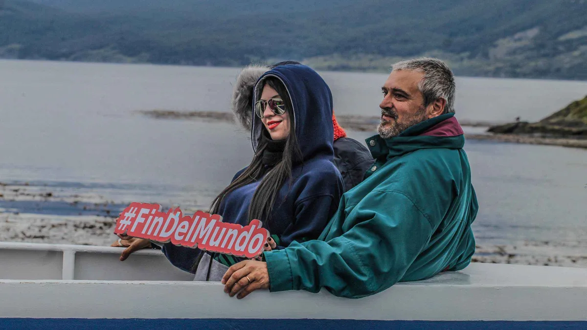
The classic three-hour channel crossing to the sea lion colony at Isla de los Lobos and the bird islands, passing the Les Éclaireurs lighthouse. The shortest way to say you have sailed the Beagle Channel.
Check AvailabilityPrices, ratings and details are the platform's own. dollar figures are the listed prices — the platform bills in your account's currency.
We may earn a commission if you book through one of our links, at no extra cost to you. Full affiliate disclosure